


Research and Science
Land Use Strata
The USDA-NASS area sampling frame delineates all parcels of land for the purpose of sampling. The area frame is constructed by visually interpreting satellite imagery to divide a state into stratification classes (strata) based on percent of land used in cultivation. Strata are typically defined by percent cultivated, non-agricultural land, urban use, agri-urban, or water.
Select a state from the map to view the most recent land use strata map for that state.
Select a state from the text below the map to download a ZIP archive containing additional files associated with that state, including shape files and a pdf formatted version of the land use strata map.
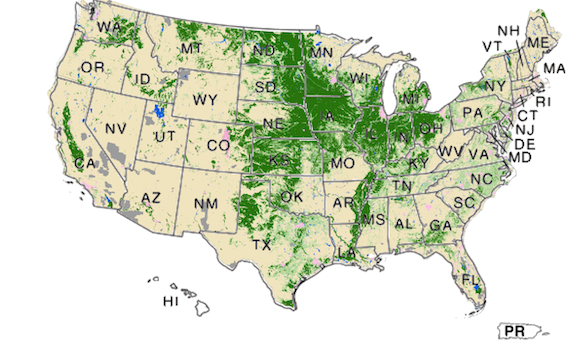
Higher resolution maps are also available: US level | US level without state labels


ZIP archives
Each individual state zip file contains shape files, metadata, a pdf formatted version of the land use strata map, as well as other files associated with that state.
Alabama
Alaska (NA)
Arizona
Arkansas
California
Colorado
Connecticut
Delaware
Florida
Georgia
Hawaii
Idaho
Illinois
Indiana
Iowa
Kansas
Kentucky
Louisiana
Maine
Maryland
Massachusetts
Michigan
Minnesota
Mississippi
Missouri
Montana
* PDF images are best viewed using Adobe Acrobat Reader.